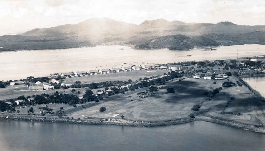
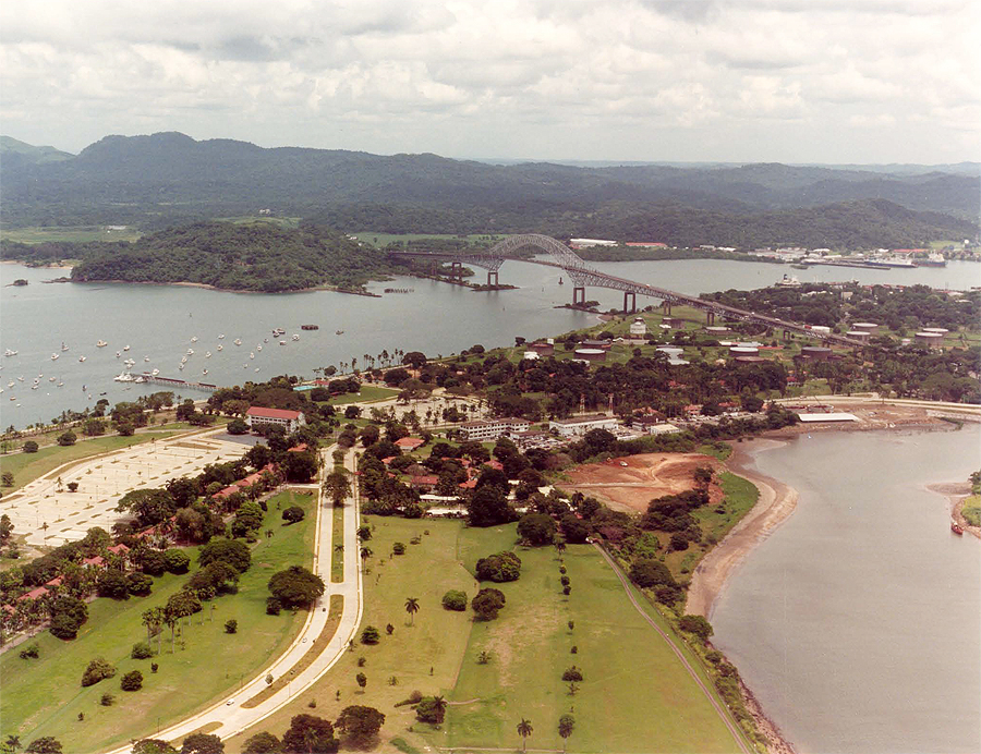
Continuing with Aerial Canal Zone, here are two great aerials taken
almost from the same vantage point. The top photo of Fort Amador
was taken in 1936 and the one below is post treaty. All the land
that Fort Amador sits on was all fill from the Culebra Cut and continued
out to the islands via the causeway. That is one great way to get
rid of all the dirt and rock dug.